Guest Post: Sag Harbor Historic and Cultural District Geocache Hunt

The John Jermaine Memorial Library in Sag Harbor, New York recently listed their 6 cache series, The “Sag Harbor Historic and Cultural District Geocache Hunt” on our website, and Garmin’s Opencaching.com. Sag Harbor is on the eastern end of Long Island, and is located partially in both the towns of Easthampton and Southhampton. Yes, they are two of “The Hamptons”, as made famous on TV, and in film. This Geocaching program is partially funded by a grant from The Town of Southhampton. There is a rubber stamp in each cache, and passports are available at the library. If you bring back a completely stamped passport, you will receive a certificate of completion. To see the whole series, you can look the profile the cache owner, JJMLibrary, or see them here on our map of caches. On June 11th, 2015, The Library blogged about the series on their blog, and we have received permission to reblog it here as a guest post.


The long-awaited Sag Harbor Historic and Cultural District Geocache Hunt announced in the May-June issue of our newsletter is now fully operational. Those of you who have stopped by the library hoping to get started on the hunt, can now pick up your “passports” (log sheets) at the library and begin searching. For those of you who don’t know what geocaching is, we’ve included an explanation below.

Important Note

opencaching.usopencaching.com
The library’s geocaches are registered on two websites: http://opencaching.us and http://opencaching.com. (They are different…one is .us one is .com). You must create a free account at one or both of these sites in order to download the coordinates of the geocaches and play our game. Due to some technical issues, our caches are NOT listed on the most popular geocaching website, geocaching.com. But both of the sites we use are good. If you are using a Garmin GPS device to search for geocaches, you will be better served by the opencaching.com. If you are using a smartphone, opencaching.us supports the greatest number of apps.

Geocaching, and the John Jermain Geocache Hunt Explained

Geocaching is a real-world, outdoor treasure hunting game using GPS-enabled devices [e.g., smartphones]. Participants use an app on their phones to navigate to a specific set of GPS coordinates and attempt to find the geocache (container) hidden at that location. Our hunt adds an additional twist.

While looking for a way to honor Sag Harbor’s contributions to Southampton Town history during the Town’s 375th anniversary year, a few geocachers on the library staff decided to combine our love of geocaching with a bit of culture and history, and a touch of the Camino de Santiago (Wickipedia: http://en.wikipedia.org/wiki/Camino_de_Santiago).

Here’s what we came up with: six geocaches are hidden around Sag Harbor. Each one relates to a member organization of the Sag Harbor Cultural District, all of which have cultural or historic significance for Sag Harbor and Southampton. (We’re not telling which organizations. It’s part of your job to figure that out.) To join in the hunt, stop into the library and pick up a free “passport.” (This is the part that’s inspired by the Camino de Santiago.) Then go hunt for the geocaches. Each cache contains a unique rubber stamp. Use the stamp on your passport…then go find another cache. When you’ve found all six caches, bring your passport back to the library and you will receive a certificate of completion (another idea borrowed from the Camino).

As mentioned above, all of the geocaches are registered on two geocaching websites: http://opencaching.us and http://opencaching.com. These sites are treasure-troves of information on how geocaching works. You’ll need to register at one of the websites in order to get access to the information about our geocaches that is stored there, but both registration, and the app for your smartphone that will lead you to the caches, are free. You’ll find a list of geocaching apps that work with various types of smartphones below. If you don’t own a smartphone but want to play, the library has a dedicated GPS navigation device that it will loan to library card holders.

Confused? Help is also available from Eric Cohen or Mireille Stürmann at the library. Call 631-725-0049 or send an email to jjlib@johnjermain.org.

Geocaching Apps for Your Smartphone

Android

  • c:geo (free and highly recommended)
  • GeoCaching Buddy (fee)
  • Columbus

iPhone

  • GeoCaches (recommended)
  • Geocaching Buddy (fee)

Windows Phone

  • Me Caching Geo
  • OpenBasic

This program is partially funded by a Town of Southampton 375th Anniversary grant.

Town of Southampton, NY 1640-2015, 375th Anniversary


Guest Post: Great Blue Heron Nature Reserve

Today, we have another guest post from The LANMonkey’s. It’s an interesting post about The Great Blue Heron Nature Reserve, in Chilliwack, British Columbia. There are a couple of good tie in’s to this post. As you may know, Mr. LANMonkey is co-host of The Caching in the NW Podcast. With his podcasting experience, he recently created an MP3 (Podcache) cache on our site, Walk in the Park with LANMonkey, in Langley, British Columbia, about 10 miles West of the Great Blue Heron Nature Reserve. What is an MP3 cache? Think of it as a letterbox type cache, where you go to the parking coordinates, and follow instructions to find the cache. But rather than written instructions, you download an MP3 file. Be sure to check it out! Additionally, we would like to announce that OCNA Admin DudleyGrunt (possibly with OCNA Admin NativTXN) will be a guest on The Caching in the NW podcast on July 2nd!


Have you ever considered whether herons nest on the ground or in trees?
 
This past weekend our geocaching adventures took us to the “Great Blue Heron Nature Reserve” in Chilliwack, BC. As it turns out, they nest in trees!

This location is quite easy to access, ample parking, and a nice selection of geocaches for the family on very well maintained walking trails. 

You can use the multi-cache “The Tower” as your reference point on the Geocaching website to navigate your way there, but it’s just a few minutes off of the Trans-Canada highway.

It’s important to know a few things before you go:

  • The trails are open dawn to dusk all year
  • The interpretive centre is open 10am to 4pm daily with free admission
  • Some trails do NOT allow dogs 🙁


Only a few of the 130+ nests here

In addition, it’s helpful to know that “parts of the Heron Colony Loop Trail and Discovery Trail are closedin the spring to allow lots of room for the herons to forage and nest undisturbed.” This doesn’t seem to impact the trails along which the geocaches are placed, so that’s great news for geocachers.

All of that said, the experience this time of year while the herons are nesting is absolutely amazing. To see these giant water-striding birds glide gracefully into their tree-top nests at the peaks of huge cottonwood trees is stunning. 

Heron in it’s tree-top nest

Our visit took us on one of two possible looping trails to pick up geocaches, but by taking the “westward” loop from the interpretive centre we were able to observe the 130+ heron nests from a distance that was safe for the herons and that our geo-hound Piggy was allowed on.

Spending some time afterward in the centre chatting with one of the staff we learned that this reserve is the largest heronry (group of heron nests) in the Pacific Northwest and that the number of returning herons (on average) has been quite steady the last several years.

Visiting the Great Blue Heron Nature Reserve is not only great way to not only spend the day out geocaching, but also to learn more about these amazing indigenous birds in their natural habitat.

Resident eagles guarding their food source
Geese with a gosling nearby


Who is LANMonkey?

The LANMonkeys are geocaching adventurers from beautiful British Columbia who’ve been having fun exploring and geocaching since Aug 2012. They love to share the great places they visit on their caching adventures on YouTube as LANMonkey’s Geocaching Adventures, and Mr. LANMonkey co-hosts the weekly geocaching podcast – Caching in the Northwest along with The Bad Cop and Witz End.

Follow their adventures on  Twitter, Facebook  and Instagram.

Guest post: Caching Cuba

We’re taking a few weeks off here at the OCNA blog, but we have some interesting guest post content coming up.  Due to a 50+ year travel embargo, many Americans, be they Geocachers or not, are not aware that residents of most Countries in the world have always been free to travel to Cuba for leisure purposes (including Geocaching). Travel restrictions to Cuba have been recently relaxed for Americans by the Obama administration, but hold on, you won’t just be booking a hotel and chilling on the beach for so-called “leisure purposes”. Not yet, at least. But it is a lot easier to get there than in the past. Refer to this New York Times article from January, 2015. We at OCNA have zero caches in Cuba, but there are currently 98 listed on Geocaching.com, the vast majority of them placed by Candian and European tourists. This post first appeared on the LANMonkey’s GeoCaching Adventures blog on April 8th, 2015. Who are the LANMonkey’s? See a mini bio at the end of the post.


Recently we returned from an amazing vacation in beautiful Cuba. We wanted to share with you how to maximize your geocaching enjoyment while still experiencing everything Cuba has to offer.

It has been a long time since we posted here last – our attention has been focused on the YouTube channel and we realize that only gives part of the story! So back to the blog.

With travel restrictions from the US to Cuba imminently lightening, we expect it will be a more popular “North American” destination soon. One of the most amazing things about Cuba is the simplicity of life while visiting there. Hopefully that doesn’t change too much, although admittedly there are many people in the country who could benefit from an economic boon (such as increased tourism investment would bring).

Varadero is circled in red at the top of the map.

We stayed in the popular resort area of Varadero, the peninsula on the North-East of the island nation where the majority of the resorts are located. A quick look at the Geocaching map shows  a number of caches all along that strip.

You can easily spend a day just grabbing the 20+ caches along the Varadero Peninsula. We’d suggest renting bicycles from your resort as most of these caches are placed along or proximate to the highway that runs the length of the peninsula. 

You can also take the 5 CUC ($5 US) “Hop-On, Hop-Off” tour buses that run the length of the highway, but they are about 30 minutes between each other and will not be efficient.

Along this stretch is an EarthCache we highly recommend, Cueva de Ambrosio (GC2DDG4). This cache was our 5,000th find milestone, but it was also amazing to explore. Also 5 CUC (you’ll quickly find a theme in Cuba of 5 CUC).

Most importantly however, is plan some time to get away from the resorts and see the rest of Cuba. One easy way to do this is to take some of the excursions – I won’t kid you, they aren’t cheap (do your research ahead of time) but the country of Cuba is amazingly rich in history and natural beauty so it’s worth the investment.


Some of the excursion we took while in Cuba & Geocaches found:

Cayo Blanco Catamaran Tour


Cayo Blanco (Traditional – GC30VV2)

Cayo Blanco Beach Erosion (Earthcache – GC3BCWP)

Jeep Safari


Cueva Saturno – Karst Cenote (Earthcache – GC5NDGX)


Bellamar Caves

Cuevas de Bellemar (Earthcache – GC26P9D)


La Habana


San Francisco de Asis, Habana (Earthcache – GC53KP8)

Most importantly – ENJOY YOURSELVES!

There were several more traditional and Earthcaches in Habana, but we couldn’t get to many others due to a tight itinerary on our tour.

So hopefully this blog will help you plan an enjoyable, relaxing visit to Cuba, where you can also pick up a few geocaches and have fun – like we did in this video!

And remember to cache safely, and cache often!

The LANMonkeys


Who is LANMonkey?

The LANMonkeys are geocaching adventurers from beautiful British Columbia who’ve been having fun exploring and geocaching since Aug 2012. They love to share the great places they visit on their caching adventures on YouTube as LANMonkey’s Geocaching Adventures, and Mr. LANMonkey co-hosts the weekly geocaching podcast – Caching in the Northwest along with The Bad Cop and Witz End.

Follow their adventures on  Twitter, Facebook  and Instagram.

OCNA Virtual Caching in Arlington, Va.

pmem


Above is the National 9/11 Pentagon Memorial. We could consider this post part of our “Things to do near Geowoodstock XIII” series, as Arlington, Virginia (which sits directly across the Potomac River from Washington, D.C.), is 61 miles from Boonsboro, according to Mapquest. We would expect many Geocachers to combine a trip to Washington, D.C, and the surrounding area with their trip to GW. On our website, we have have 5 virtual caches within a .9 mile radius of a point centered in Arlington National Cemetery, and they are all excellent. They are:

They are NOT, however, the only OCNA caches in Arlington; they are merely the 5 featured virtual caches within a .9 mile radius. You could spend a whole day finding OCNA caches in Arlington; we have 13 of them (the first 13 in that search), including another Virtual and a Webcam. Read on for more info on the 5 featured Virts.

Read More

GeoWoodstock XIII ideas; Cycling in Hancock

640px-1633_-_Hancock_-_MD144_viewed_from_US522


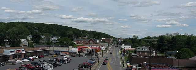
In our last blog post about the Sideling Hill cut on I-68, we were about 35 miles from the site of GeoWoodstock XIII in Boonsboro, Maryland, and we’re inching closer! Above is a view of Hancock, Maryland from U.S. 22 (photo by Andrew Bossi), which is about 6 miles east of the cut, and about 30 miles from GW. Are you bringing a bicycle to GW? (You can rent one too); then Hancock is the place to be! If you don’t believe us, note that there is an official GW Cycling “after event” (created by the GW XII committee), On Sunday Morning, May 24th in Hancock.

Read More

Featured OCNA Cache: Route 40 – Town Hill Overlook

Photo courtesy of Town Hill Hotel B&B

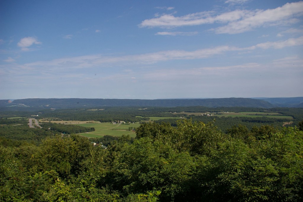
With GeoWoodstock XIII in Boonsboro, Maryland just over 3 months away, this is the first in a series of featured OCNA caches in Western Maryland. The State of Maryland ranks 3rd on our website in number of active caches by State and ranks 4th on our website in activity by State (number of cache searches). Expect some travel tips too; today we even have a lodging recommendation! Above is the view from the Town Hill Overlook along U.S. 40  in Little Orleans, Maryland. At this scenic overlook, which sits at an elevation of approximately 1,660 feet, and has had the title “the beauty spot of Maryland” bestowed upon it, you can see 3 States and 7 Counties. You will also find a Geocaching.com listed cache there, as well as our featured OCNA cache, a virtual, Route 40 – Town Hill Overlook.

Read More